
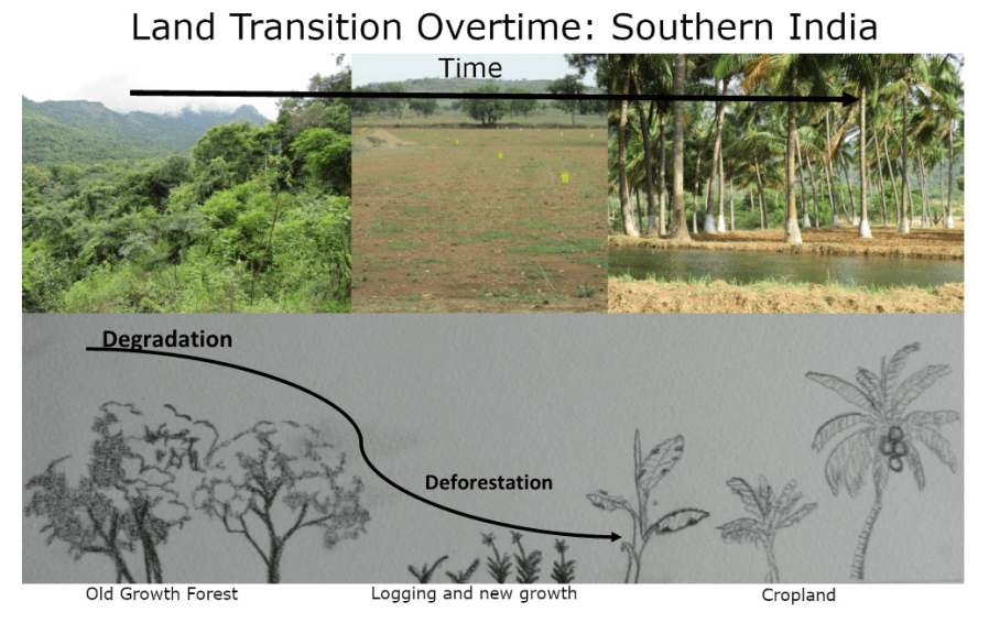
I created this figure to depict how the land in India has been changing over the last several decades.
My study is focused around human-elephant conflicts in India which has tied in with the changing land use of the area. To understand the issues surrounding human-elephant conflicts it is important for researchers and the public to understand the landscape of the region and how it has changed over time.
The study site is located in southern India bordering the Western Ghats Mountain Range, this mountain range is one of four ecological hotspots in the country. The overall objective of this research is to better understand any drivers behind elephant crop raids in the area and investigate feasible mitigation methods.
This image helps illustrate how the landscape of the area has changed from old-growth forest into cropland. More recently there has been a large portion of land being sold for real estate options in addition to the cropland. The goal of this image was to convey this message to someone who has never visited India before.
Often times, the media is cast with images of the overwhelming human population of India or the amount of pollution seen, while images of the mountains or farmland are overlooked. Utilizing this image allows for a conversation to be had about the habitat loss in India which is thought to be a large driving cause for elephant crop raids.
There were a few images which helped inspire my image, these can be found below in the reference images. While the first two reference images were still important in the creation of figure 1, figure 4 was the most influential. Figure 4 is something I believe could be seen in a poster presentation or an informative website that would spark a conversation or discussion about deforestation and land disturbance overtime which is what I was aiming for with my own image.
I hope a figure like this can be used for my own research in the future to discuss solutions with land owners and managers in India. In order to make this image ready to publish or share with stakeholders I would need to make the hand drawn images more clear by animating them and using colors that would draw attention to the image.
|
Figure 2: Illustrated forest transition model in the Tata Hills of Kenya (Pellikka, et al., 2018)
Figure 3: Animated forest system depicting forest degradation and deforestation (What is Forest Degradation: Definition, Causes, Effects & Soluation, n.d.)
|
Figure 4: Animated image showing degradation of tropical forests after disturbance (Sist, Rutishauser, & Blanc, 2015)
|
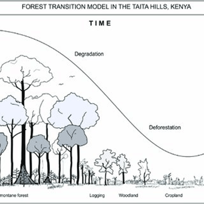
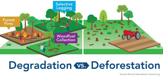
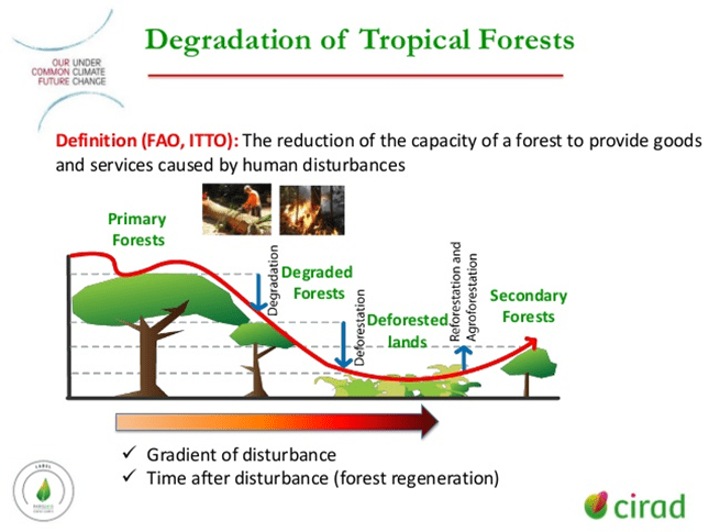
Fig. 2: Pellikka, P. K., Heikinheimo, V., Hietanen, J., Schafer, E., Siljander, M., & Heiskanen, J. (2018). Impact of land cover change on aboveground carbon stocks in Afromontane landscape in Kenya. Elsevier.Fig 3: What is Forest Degradation: Definition, Causes, Effects & Soluation. (n.d.). Retrieved from Eschool: https://eschool.iaspaper.net/forest-degradation/
Fig 4: Sist, P., Rutishauser, E., & Blanc, L. (2015, July 22). Ropical Forest Degradation in the Contect of Climate Change: Increasing Role and Research Challenges. Retrieved from slideshare:
https://www.slideshare.net/CFCC15/sist-p-201507081430unescobonvinroomxiii
